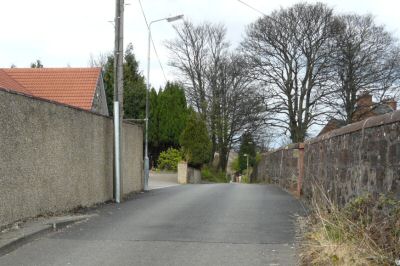
Place Names (M) MacDonald Walk - Main Street, Bonhill
MacDonald Walk, Balloch
Like its near neighbour Lynn Walk, MacDonald Walk is named after a Balloch family with boating connections, this time as captains of the Loch Steamers. There were a number of them, and in fact the last master of the Maid of the Loch in her sailing days was Captain MacDonald. The houses on the Walk, which is in the Dalvait Estate, were built in the 1970's.
McGregor Walk, Tullichewan
A report in the Lennox Herald of 14th March 1964 tells us that the Walk was named after Donald McGregor who was the first Labour candidate to be elected to Dunbarton County Council in the Vale. Standing in 1919 in Alexandria East the additional bonus to the Labour group of his victory was that the defeated candidate was none other than William Ewing Gilmour, whose political reputation had suffered a very great deal in the Vale in the previous years.
Donald McGregor went on to represent many wards in Alexandria, but never Tullichewan. To begin with he represented Alexandria East on the County Council from 1919 until 1929 and then he switched to the new seat of Alexandria North when the County Council was reconstituted in 1929. He stood down in 1932 but returned to the fray in 1935 when he won Millburn which he represented for many years. He is another where the prominence of the thoroughfare in no way reflects the contribution which he made.
There were another two Councillor McGregors, who did actually represent Tullichewan in the 1930’s and 40’s, but then they were Moderates rather than Labour councillors. Archibald McGregor was elected the County Councillor in 1935 and 1938, while William McGregor served a single term 1945-49 as a District Councillor.
Main Street, across the Vale villages and towns, except Balloch
All of the towns and villages of the Vale, except Balloch, have a Main Street. These streets were originally two tracks, one on the east bank and the other on the west bank of the Leven, which led through the Vale from time immemorial.
Both of theses tracks were made up into military roads. The Dumbarton - Inverary military road was built 1746 –48. It was the basis for both Renton and then Alexandria Main Streets, both of which were probably known by that name from about the time of their founding in 1762 and 1788 respectively.
The Dumbarton - Stirling military road was built through the Vale in about 1755, and it was the basis of both Bonhill and Jamestown Main Streets, which were probably not called that until about 1800 and 1830 respectively.
Main Street Alexandria becomes Main Street Renton at the Mill Burn, while Main Street Jamestown becomes Main Street Bonhill at Sandbank, although that is a comparatively recent arrangement. By definition, these were the most important shopping and business streets in each town or village, although in Alexandria Bank Street ran Main Street close until redevelopment in the 1960' - 80's.
Main Street, Alexandria (for many years the A82, and since the opening of the Alexandria bypass in 1974, the B857).
Main Street, Alexandria was for many years the A82, and since the opening of the Alexandria bypass in 1974 it has been the B857. It runs from Mill Burn in the south, which is both the Street's and Alexandria's, southern boundary, through the town centre to King Edward Street. North of King Edward Street it becomes North Main Street for the short distance to Argyll Street on whose northern side it becomes Luss Road.
It was from time immemorial a track and drove road, and then was made up to a military road, as part of the Dumbarton - Inverary military road 1746 - 48. That was very handy indeed for the Smolletts, who decided in 1788 to lay out the new village of Alexandria - they had a fine thoroughfare newly built by soldiers, on a route which lay directly to the newly built bridge at Dumbarton in one direction and to the newly-safe Highlands in the other.
Another well-used thoroughfare already joined it in the middle of their proposed new town. This was Ferry Loan, later Bank Street, which led down to a ferry and ford over the Leven. Ferry Loan joined Main street at an old oak tree at a place called the Grocery. At this junction stood the only shop for the west side of the Vale in the latter half of the 18th century, hence the name. When Alexandria was named there already was a small community in existence around the first of Alexandria's textile works, Levenfield, which started in 1768, close to the Leven just north of Lunnbrane Hole.
Ferry Loan today
There weren't actually any roads as such in the area, just short stretches of tracks around the houses, which weren't joined up. In the 1790's what became Main Street was still a pretty straight road through green fields. As it entered Alexandria from Renton, a track ran down to the east to Place of Bonhill House and the towpath, and opposite it was the Pyroligneous Dye Works at what is now Millburn Depot, which started in the 1790's. As it went north the incline probably was not so great because it didn't have to cross the railway line, and about where the bridge over the railway now is, a track led off west to Millburn Farm on the hillside.
The first houses to be encountered were at Rowantreebank - not the one presently bearing the name at the corner of Upper Bridge Street, but the one immediately to the south of it, and the adjacent building. A track where Overtoun Street now stands led up to a couple of farms on the hillside, while on the east side of the road, in the triangle formed by Main Street and Ferry Loan, there was a farm steading with some out buildings. To the north of the Grocery, the first building was the South Lodge to Tullichewan Castle, dating from the 1790's, and still standing.
The next feature was the Long Avenue, now known as the Heather Avenue. It was also the last one at that time on Main Street. However, things changed quickly, because when the poetess Dorothy Wordsworth passed along the road in 1803 to go on a tour to the Loch, she commented on the workers' tenements in both Alexandria and Renton.
From 1800 onwards, a number of small houses were built on the steading land to the south of the Grocery, and these small houses were later (probably about 1850-60) replaced by two-storey buildings, a number of which still stand to-day between the Fountain and the Bank of Scotland on Main Street. At the same time new streets were being laid on the east side of Main Street such as Mitchell Street and Croft Street. In 1816 the Parish School, which had stood on Cameron Estate, close to Cameron Brae, was transferred into Croft Street by popular demand of the growing number of Alexandria residents.
By the 1820's, North Street appeared and was for many years, the northern limit of the village. Tenement buildings had been built in the late 1820's / early 1830's on the west side of Main Street from the Oak Tree northwards, and behind them was a warren of further houses and small workshops. In there was a blacksmith's shop and the smith was at one time Jock Lockhart so the lane connecting Main Street and what is now the car park adjacent to Leven Cottage, became known as Jock's Loan, or Lockhart Street. It was also known, sarcastically, as Sauchieha, which also happened to be the nickname of the tenement building on Main Street down whose side it ran.
Just a little to the north was a tenement nicknamed “Castle Dangerous” which stood on the ground now occupied by Glen's garage. The name was probably derived from the novel of that name by Sir Walter Scott of 1832, so that dates the building pretty well. It was only knocked down after the war to make way for John Glen's first garage on the site.
Expansion was continuing to the south of Main Street as well. In 1840, the Church of Scotland got round to building the Parish Church. Although the building still stands, it has been a children's playground since closing as a Church in 1994. But even before that, it had amalgamated with Bridge Street Church in 1987 to form a new congregation of St Andrews Parish Church.
About 1850, a large new school was built across Main Street from the Parish Church. This was called Main Street School and was the non-denominational school for the centre of Alexandria until 1963 when pupils and staff moved into the old Vale of Leven Academy building in Middleton Street. This had been newly vacated in 1962 when the secondary school moved to its new site at Place of Bonhill, adjacent to Main Street at its southern boundary. The old Main Street School was demolished and replaced by Alexandria Leisure Centre in 1973.
By 1850 a series of two-storey tenement blocks, many with shops on the ground floor, had been built on both sides of Main Street from the Oak Tree to the Church. Ann Street (which didn't become Church Street for another 50 years) now ran from Main Street down beside the churchyard to John Street at its junction with Random Street. Beyond that, Bridge Street had been laid out soon after the opening of Bonhill Bridge. However, Bridge Street took many years to complete - buildings were erected whenever someone had the cash, and in no particular order - they didn't start at the Leven and work westwards or vice versa. Also the railway had to be accommodated, so there was a sort of mid-century hiatus in the development southwards of Main Street at Bridge Street.
It does seem likely that the Albert Hotel (later the Griffin and finally the Alexandria Hotel) was built about 1860, and stood on its own for some years. The late 1840's saw further expansion northwards when Wilson Street began to be take shape, but like Bridge Street this was spread over a number of years. Wilson Street remained the northern edge of the housing in Alexandria until the arrival of the huge Argyll Motor Works in 1905 and the building of King Edward Street, Govan Drive and Argyll Street in 1907.
The building of the railway, which opened in 1850, changed the alignment of Main Street very slightly with the building of the bridge over it towards the south end of the town. A bigger change was the chopping down of the Old Oak Tree at the junction of Main Street and, what was by then definitely Bank Street, in October 1865. The Oak had been badly damaged in a gale and was now a danger to the public, but it was sadly missed. The Oak Tree was the meeting point in the Vale and many political demonstrations and religious meetings had been held around it. That function was carried on by the Fountain, which was built in 1870 just a few yards from where the Oak Tree has stood. It commemorates Alexander Smollett who had been the local MP.
In the meantime, the Vale of Leven Bowling Club had opened on its present site on Main Street in 1867. In 1878, the fine tenement that still stands there, replaced the old houses at Fountain Place. The late 1870's and 1880's were a time of economic and building boom in both Alexandria and Renton. Detached cottages were built in Middleton Street, and in 1880 two streets - Fountain Street (later Gilmour Street) and Hill Street were laid out from Main Street to give access to Middleton Street.
At about that time, too, Wattie's Loan was made up to become Overtoun Street. Further south on Main Street, a number of fine new red sandstone tenement buildings were being erected and behind them lay the new Victoria Street, which was accessed from Albert and Arthur Streets.
Completing the set of these new buildings was perhaps the finest red sandstone terrace in Alexandria, Millburn Terrace, which stood where Main Street now takes a sharp turn to the east to join the town centre bypass. On the west side of Main Street a number of attractive villas, still standing, were built in the 1880's and 90's. The last building of the 19th century at the south end of Main Street was St Mungo's Episcopal Church, which was completed in 1895.
The last houses at the northern end of Main Street from about 1870 until 1905 were at Wilson Street. On the west side was Nottman's Park, which was a rough field, standing where the Christie Park does now. It was used for occasional functions such as the Cattle Show.
Nothing changed until 1902 when the Christie Park was laid out. Three years later, in 1905, the large area of green fields, broken only by the Heather Avenue, was swallowed by the Argyll Motor Works, one of the largest and most advanced motor car factories in the world at the time, which was just over a year in the building, opening in 1906. At about the same time, houses were being built for the people who were going to work in the car factory, many of whom were coming from Glasgow. King Edward Street, Govan Drive and Argyll street were all built by 1907, as were Co-op houses and shops opposite the entrance to the Christie Park.
In 1908, another significant innovation came clattering along Main Street - the Dalmuir to Balloch tram. For most of the way, it was single track, but there was a section of double track along much of Main Street, while at the Fountain, there was a junction at the top of Bank Street, where the tram to Jamestown terminated. It only came onto Main Street to go to and from its depot in Dumbarton. The trams only lasted 20 years until 1928 when the competition from the more flexible, and faster, buses put them out of business.
Occasionally when roads are being repaired, an old tramline is uncovered to remind us of their long –gone presence. They certainly lasted longer than the Argyll Motor Works, which closed down in June 1914. Had this Works survived a few more weeks until the outbreak of war in August 1914, then their history, and the Vale's, would probably have been very different.
As it was, the Works didn't lie empty for long, being taken over in 1915 by Armstrong Whitworth for munitions manufacture. They also took over the last green field on the east side of North Main Street, as it is now called. An explosive works, making Lyddite, and therefore called “the Lyddite” was built on the area now occupied by the Swimming Pool, but running right down through what became Argyll Park in the 1930's, to the railway line.
It was quite an area, and because of the very real risk of explosion, much of it was in underground bunkers and pits. When the Argyll and the Lyddite were shut in 1919, the Lyddite became a favourite playing field for local children. Part of it lay open and derelict until the 1950's when it became football and hockey pitches for the Vale Academy, before being used as the site of the Swimming Pool, which opened in 1973.
Maycrete single-storey houses were built on another small part of it as a sort of evaluation project, just before World War Two, but these were also demolished to make way for the Swimming Pool. Until 1935 when it was taken over by the Admiralty as the Royal Naval Torpedo Factory, the works were largely unused, although for a short time in the early 1930's at the height of the Depression, a trades school to train unemployed youths was opened in it, without any recorded impact.
Of lasting impact, however, was the War Memorial standing in the Christie Park, but looking out onto Main Street. Bearing more than a passing resemblance to the Cenotaph in Whitehall, it was unveiled in 1922, and contains the names of 363 servicemen killed in the First World War, and 78 from the Second. The servicemen had been promised, “homes fit for heroes”.
Despite the financial difficulties of the 1920's and 30's, County Council housing estates were started on Main Street. The first was in Burnbrae about 1925, and the fine red sandstone semi-detached houses on Main Street were the eastern side of this estate. In the late 1920's, houses were built on the southern Main Street and on a new side street, Allan Crescent. This was the last significant change in Main Street until the Vale of Leven Academy was opened in 1962 at Place of Bonhill.
This was closely followed by the planning disasters of the late 1960's through to the mid 1980's, which destroyed the character and fabric of the town centre and much of Main Street. The most contentious part, and the one which did by far the most long-term damage, was the building of the so-called town centre bypass (see also the Alexandria web page).
The town centre bypass brought about two major changes to Main Street. Firstly, the alignment of the Street was changed and a sharp bend to the west was inserted opposite the English Church to create a junction with the new town centre bypass. This created confusion for many years, and even yet an occasional stranger travelling south carries straight on, instead of turning left, and bumps over the pavement at the railway bridge back onto Main Street. To create this junction, one of the finest buildings in the Vale - Millburn Terrace - was demolished.
Further north on Main Street, especially on the east side of the Street, from 1971 onwards, different sections of buildings were demolished to accommodate the changes taking place behind them. The buildings on both side of Mitchell Street were knocked down, and then most of Church Street and all the buildings between Church Street and Bridge Street. A few years later, the remaining buildings up to the Bank of Scotland were also demolished and replaced by new shops.
It was not until about 1979, that there was much change on the west side of Main Street - and that started with a fire in what had been Biagi's chip shop at the corner of Overtoun Street, resulting in it being pulled down. About 1980, the shops from Overtoun Street north to the Gas Showroom were demolished, to be replaced by new shops. In the early 1980's, the remaining tenements to the south of Overtoun Street were also demolished, leaving a gap site for nearly 20 years, which was eventually made into a car park.
Around the Fountain, and northwards, things didn't change quite so much. In the 1950's, the older tenements on either side of Hill Street were demolished, and were replaced by Leven Cottage and an earlier version of John Glen's garage. The tenement, which housed the Green Oak fish and chip shop, survived for a few more years. When it went, the whole site between Hill Street and the Bowling Green was taken over by a new garage building.
The other major change was between the Fountain and North Street, and much of that was quite recent. The redevelopment of the 1960's and 70's saw Croft Street reduced to a stub, and that saw some gaps appearing at its junction with Main Street. However it was the Health Board plans for a new Medical Centre which saw the demolition of the old buildings on the east side of the Fountain.
More recently, the old buildings, including the 170-year-old single-storey buildings, on Main Street between the Fountain and North Street, were flattened. These disappeared from about 2000 onwards to be replaced by gap sites and inaction by the Health Board. However, there have been some upsides in the last year or so. Local shopkeepers, in conjunction with the council, have implemented a program of upgrading shop fronts around the Fountain. For a comparatively small outlay, the results have been very effective indeed, giving the area as a whole and the participating shops in particular, a fresh, attractive look, which hopefully will pull in more shoppers.
Main Street, Bonhill
The history of the town of Bonhill, especially in its early days, is virtually synonymous with the history of two streets - what became Main Street, and the Burn, which became Burn Street. Of these two Bonhill thoroughfares, Main Street is the oldest in layout if not name. It is based on a very old track, which became a drovers' track, then part of the Dumbarton - Stirling military road of about 1755. In the 19th century it was made up to handle the thriving commercial traffic associated with the 4 textile works that stood on or close to Main Street at different times.
From about 1270, much of the Vale was in Bonhill Parish and from about that time till now there has been a Bonhill Parish Church. There were many different Church buildings over the centuries, but it is thought that all of them were the same general area as now i.e. adjacent to the Main Street. The Churchyard was the burial ground for the Parish from an early date, and the interment there in 1685 of Robert Napier, a martyr of the Covenanting cause, is very well documented.
It is likely that the track of Main Street dictated the location of the Church rather than the other way round, for all of Bonhill's Protestant churches over the centuries stood on were accessed from Main Street. The first Parish Church for which details exist was built about 1700 to replace an earlier one. In turn, a much larger one, for which a manse was built in 1758, replaced it in 1747. As the population grew another replacement was built in the 1770's near to the river, but its foundations were poor and the present Church was erected in 1835, closer to Main Street.
That was a time of great change in Bonhill, in industry, population social conditions, and even in church affairs. In 1831, before the present parish church was built, a different brand of Presbyterianism - the Relief Church - had built its new church on a hill overlooking and accessed from Main Street at the north end of the village. It subsequently became Bonhill North Church, but is best remembered as Mount Zion. Initially it was accessed via another of the Bonhill's and the Vale's better known streets, the illustrious Cannon Row, or as it was originally known, Church Row.
Mount Zion closed in the 1970's and stood derelict into the early 1980's when it was demolished and replaced by a private house. In the 1830's, however, its building was a significant extension northwards for Bonhill. Then, indeed for decades later, that part of Main Street was known as the Jamestown Road, and only Dalmonach Works and then Dalmonach School lay north of the ferry.
The Disruption in the Church of Scotland in 1843 resulted in a third church being built on Main Street - the Free Church, which was built in 1847 at the top of the brae. After the churches were re-united in 1929, it became Bonhill South, but is probably best remembered as Alan Hasson's church after its charismatic, if eccentric, minister of the 1950's. It also closed in the 1970's and was demolished to make way for houses on Main Street in 1979.
It is worth noting that the apparent plethora of churches on Main Street is more than offset by the number of licensed premises - in the 1820's Bonhill had more than 20 pubs, plus its own distillery (which burned down in 1827 and has not been replaced, so far, but many live in hope) and while this had been reduced to seven by the 1840's, of which at least five were on Main Street, even in 1980 there were four licensed premises between the Bridge and Dillichip Terrace on Main Street.
The growth in the village was fuelled by the building of four textile works in Bonhill, as well as by those across the Leven. Three of the works were on or directly accessed from Main Street, while the fourth's (Dillichip) entrance was at the end of the long Dillichip Loan, which joined Main Street at its southern end. The first of these works to be built was at Dalmonach, at the north end of the village, in 1786. It closed as a textile works in 1929, but was used as a barracks during the Second World War, and housed many small businesses for many years after it.
In all of its early documentation Dalmonach Works refers to itself as being located in Jamestown Road rather than Main Street, which gives some indication of how recently the Bridge - Sandbank stretch has actually been called Main Street. Dalmonach was burned down in 1812, but rebuilt under the direction of Henry Bell, of the steamship Comet fame.
Just outside Dalmonach factory gate, standing adjacent to, but not on Main Street, and surviving the 2006 demolition of the old factory buildings, is Dalmonach Schoolroom. This dates from the 1830's and was the works school where children (and some adults) who worked in the factory, received a rudimentary education. It was very successful in its day, attracting pupils from all over the Vale. It closed as a school in 1870 when the Parish School Board took responsibility for schooling.
The next textile works to be started was the Wee Field, which opened in 1793, wedged between the Church, Main Street and the Leven - there is a very good engraved illustration of it from sometime after 1835, which includes the present Parish Church, the Burn and many of the houses on the north end of Main Street. The Wee Field closed in about 1840.
In 1836 the third works accessed from Main Street was opened, just south of the churchyard, close to the river. This was Kirkland Printworks, and after the building of the Free Church in 1843 it lay between that church and the river. It only lasted about 30 years, being bought by Sir Archibald Orr Ewing to be demolished in 1868, to make way for a new house for the manager of Dillichip Works. Its name lives on in Kirkland Lane, which runs off of Main Street.
The fourth works, Dillichip, was accessed via Dillichip Lane or Loan. It opened in the 1820's and closed as a textile works in 1936. These works brought in many newcomers who needed houses, shops and schools, Naturally they settled firstly on either side of the existing road (Main Street) and also on both sides of the Burn, which brought a plentiful supply of water. From the outset, the Burn and Main Street were the core of the village.
Even with all the changes of the last 20-odd years, it is possible to trace the original outline of Main Street and to see evidence of its development over 200 years or so. Now it extends from its southerly junction with the A813, Stirling Road, through Old Bonhill village, rejoining the A813 just north of where the Burn tunnel has run under it since 1929. At this point the A813 is renamed Main Street, until it leaves Bonhill at Sandbank, to become Main Street Jamestown.
Until the building of the hillside housing estates from the 1960's onwards, and even for some time after that, the old line of Main Street prevailed - the old military road came straight down Nobleston Hill as the “Low Road”. In the 19th century, the “High Road” ran from about the present Main Street / Stirling Road junction to-wards Hillbank, effectively bypassing the village. In those days Main Street started about Dillichip Loan. It then went on through the town down the Brae, on to-wards Bonhill Bridge in a gentle westerly curve, and in the few yards between the Dummy's stairs and the Canon Row it informally became the Jamestown Road.
Before the factories were built in Bonhill there was only the Church and a small number of farms whose names such as Nobleston and Ladyton have lived on. There was also a ford across the Leven, entered from Main Street. Soil deposits brought down from the hillside by the Burn over the centuries causing a shallow bank created it. The ford is still quite discernible in the river, if not quite accessible from Main Street.
This ford provided Bonhill with its early southbound through traffic, the main part of which was cattle drives from Argyllshire and the Lochside to market in Glasgow. Even as early as 1664, this trade was being called “past memory of man” by the drovers, who at that time were in dispute with the Keeper of Dumbarton Castle who was levying a toll on droves across the ford at Dumbarton. Part of his case was that the road between Stirling and Dumbarton, which passed through Bonhill, had “neither meat nor safety”. Main Street was therefore a significant droving route from the Middle Ages right up until droving died out about 1900.
Bonhill ford, and the ford at Balloch, were especially busy each autumn from about 1770 onwards when Falkirk Tryst became the main cattle market in Scotland. After crossing the Leven, initially by ford, and after 1836 by the first Bonhill Bridge, the cattle drives had a variety of choices, but they all involved Main Street at the outset. If they turned left after crossing the Leven, they went past Dalmonach and headed either for the Auchincarroch / Cameron Muir Road, or Balloch / Gartocharn. If they turned right (a very slight right, if they were crossing the ford) they then went left into the Burn, up past the quarry and onto the hillside drove road to Killearn.
An indication of the importance of a village to the droving trade was the presence of a pub called the “Black Bull”. Almost every Scottish droving village had a Black Bull Inn and Bonhill was no exception (neither were Renton nor Alexandria).
At some stage, a Ferry was added to the ford crossing, under the ownership of the Smolletts. The line of the ferry crossing was about where Bonhill Bridge is at present, and it crossed from Main Street to the bottom of what was then Ferry Loan, Alexandria (renamed Bank Street in the 1850's). A dental surgery now stands more or less where the Ferryman's house was in Bridge Square.
From the early 1800's it was clear that a Bridge was needed to replace the Ferry and eventually Smollett of Bonhill, who owned the Ferry, agreed to the building of Bonhill Bridge in 1836. Because it was wrongly, even illegally, built as a toll bridge, it became known as the Bawbee Brig, and was the centre of very heated controversy for 60 years until tolls were abolished in 1895. It was the first bridge across the Leven to be built in the Vale. This suspension bridge was replaced by a new one in 1898, which itself was replaced by the present “Rainbow” bridge which was opened in 1987.
By 1836 the bridge was very much needed because in the 40 years to 1830 population of Bonhill had grown from a few farmers to about 1,500, and would continue to grow for the rest of the 19th century. Increasingly, it became self-sufficient in other essentials of 19th century life - shops, doctors surgeries which also doubled as chemists shops, and even a bank - a branch of the Commercial Bank which opened in 1842 on the west side of Main Street, opposite the Burn.
Most, though by no means all, of these businesses were located on Main Street, in the new two-storey tenement buildings that were built along the length of Main Street from the late 1830's onwards. The opening of the Bridge attracted many houses and these shops northwards to stand between the Burn and the Bridge. By that point there wasn't room for buildings between the Street and the Leven, so from just north of the Burn only the east side of the Street had houses on it. In the 1870's the Vale Co-op opened 4 new shops on the Brae in Main Street and kept shops there for another 90 years or so.
In 1874, a fine new Primary School was opened in Braehead, replacing two in the Burn, including the Parish school. It is still in use, although the large gap site opposite it on the east side of Main Street is apparently designated as the site of a replacement school.
By the end of the 19th century, social conditions in Bonhill were worse than any other part of the Vale, with an outbreak of typhoid in Braehead as late as 1900, as well as other infectious diseases such as small pox, just before that. Sanitary and housing conditions generally were pretty bad, and the open Burn was also a major health risk, since it acted as sewer and informal water source.
After the First World War Bonhill had its fair share of the first round of council house building in the Vale, with new council estates at both George Street and Hillbank in the 1920's. The Burn was enclosed in a culvert in 1929. The new council houses in turn led to slum clearance elsewhere in Bonhill, including in Main Street. Some of the cleared sites on Main Street in Braehead had new council three-storey tenements built on them in the 1930's, while in other cases, the gap sites remained just that - gaps.
The cleared sites on either side of the Eagle Inn were a case in point. The slump in the 1920's and the Depression of the 1930's meant that little further development took place on Main Street, until after the Second World War. The building of the Dalmonach Estate in the late 1940's and the general economic prosperity in the Vale saw Bonhill perk up again. The shops on the Main Street enjoyed a post war revival, almost until they all disappeared in the wrong-headed road re-alignment, which was the last unfortunate phase of the hillside expansion.
It seemed by the late 1970's that the new road system into the O'Hare, Ladyton etc estates was working perfectly well - a bit of re-alignment of Burn and Hillbank Streets, but maintaining as much of the existing Burn and Main Street as possible. That something is working well often appears to be a major challenge to a typical planner. What makes Main Street's plight even worse is that the lessons were all in clear sight from the accumulated evidence of the mistakes made 15 years before in Alexandria's redevelopment.
The Main Street road designers created a major operational flaw of their own at the Main Street / Bonhill Bridge junction, where a southbound filter lane or a roundabout is a clear requirement. The buzz and bustle of Main Street disappeared when the shops and pubs were demolished, and empty spaces are the predominant feature of Main Street. Quite an indictment, and all avoidable.
![]()