BONHILL PAGE 1
PAGE 2 | PAGE 3 | PAGE 4 | PAGE 5
"And thus Bonhill must be a happy place,
Tis peopled with a cheerful busy race."
Bonhill is the name of both the ancient Parish, which covers most of the Vale - with the very significant exception of Renton - and the hamlet, then village, and eventually town that grew up around the Parish Church of Bonhill. The Parish is described in the Place Names pages and this page concentrates on the town.
A village and then town would probably have evolved anyway at what is now Bonhill from the late 18th century onwards, as a result of the textile finishing industry finding the Vale such a congenial spot. However, the fact that this was the first church in the valley of the Leven, and that the church was from the 13th century onwards the centre of the Parish, undoubtedly played a key part in the development of Bonhill.
More importantly, it also meant that over the centuries the history of Bonhill is illuminated from time to time in a way that no other part of the Vale is, with the possible exception of Balloch. Every hundred years or so a Royal charter or an Earl's grant tells us of some part of Bonhill being given to someone or some church organisation. While this is pretty sparse information, it's enough to get started with.
We don't know why Bonhill was chosen as a Parish or whether the Church was there before Bonhill became a Parish. We do know that the first written reference to Bonhill refers to the Parish of Bonhill. This was in 1270 when a charter of Maldowen, the 3rd Earl of Lennox makes mention of “Hachenkeroch in the “Parish of Buthelulle”. Thus not only is Bonhill identified in 1270, so too is Auchincarroch.
The origin and derivation of Bonhill offers many choices. There is firstly, a belief in the Gaelic “bog n'uill”, meaning the foot of the rivulet i.e. the Burn. Or you can have the foot or base of the hill. The spelling gradually changed. Starting with the written Buthelulle it then became Bollul. That lasted until about 1550 when it became Bonyle, then Bonuil or Bonill, and finally settled for Bonhill by about 1700. Locals to this day tend to call it Bonill or B'nill so perhaps this has stuck.
The Church probably dates from the 13th century and it is likely that it stood in the general area where the present church stands. It would have been a very small building as befitted the small population of the Vale in the Middle Ages. It stood amongst a small farming community. In the early 1300's there is reference to Nobleston - the “50 shilling lands of Bonhill”. Just over a century later in 1453, Isabella Countess of Lennox, from her long-term home in the Castle of Inchmurrin, established St Mary's Collegiate Church in Dumbarton, which was a semi monastic “community” of priests.
To pay for the upkeep of this Church Isabella gave them certain lands in what became Bonhill and also the patronage or living of Bonhill Parish Church. One of the lands, which she gave, was the farm town (town is something of an exaggeration) of the Church of Our Lady, or Ladyton, as it soon became known.
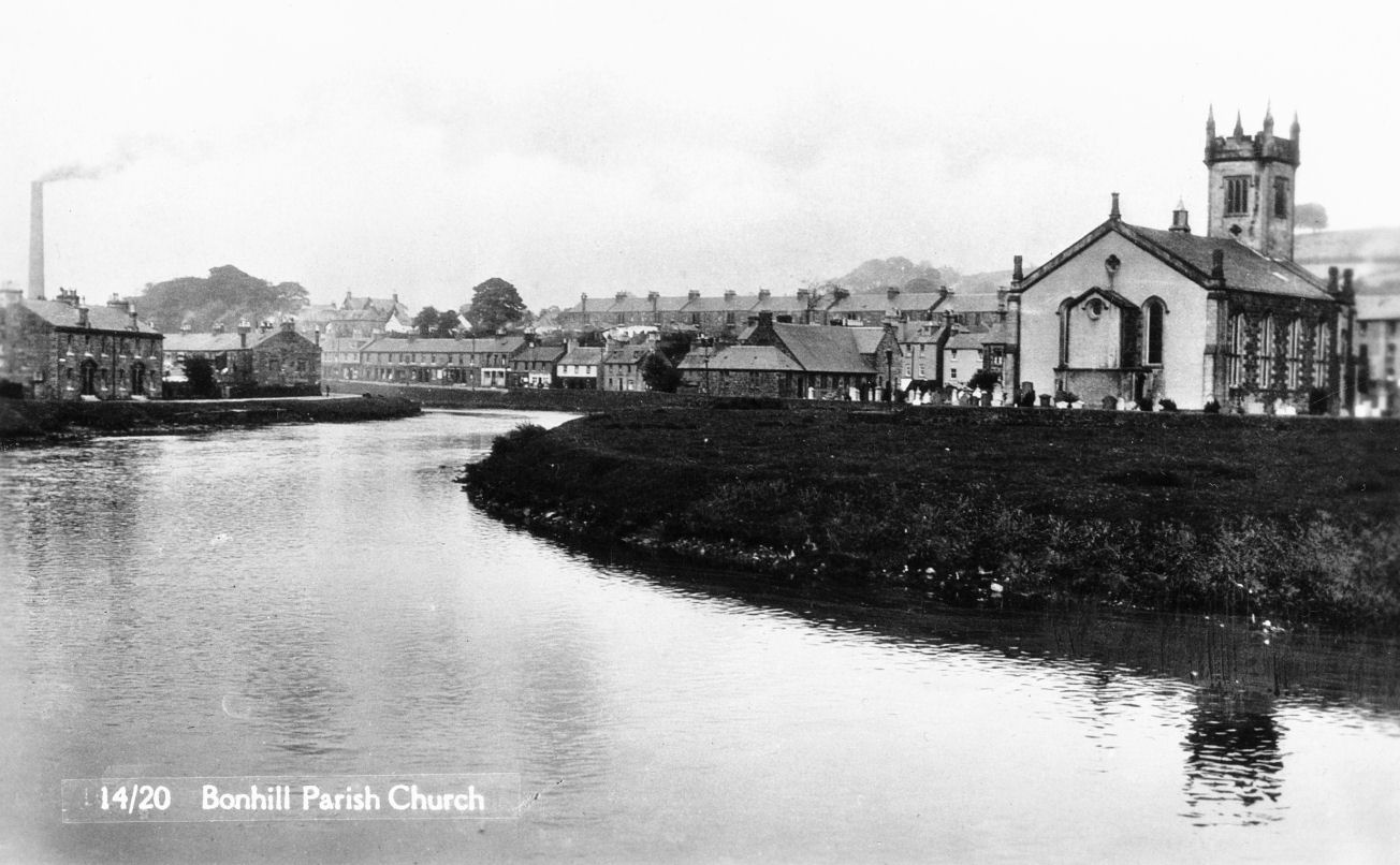
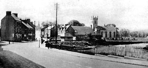
Bonhill and the Church (Click to enlarge)
Long before that, in 1330, the Earl of Lennox gifted the salmon fishing at the pool of Linnbrane to the monks of Paisley Abbey. The adjoining land on the east bank of the Leven was where the monks laid out their nets to dry and this became known as Dalmonach, or “the field of the monks”.
All of this information is at best sketchy, but already three place names - Nobleston, Dalmonach and Ladyton - have been identified which were to gain considerable significance in Bonhill in later centuries.
All of these places had Church connections, but that's not surprising since the Church's role was pre-eminent in all aspects of life in the Middle Ages. The Reformation of the 1560's saw the demise of the monks, priests and many of the land ownership arrangements that operated in typical Parishes such as Bonhill. Two of the most notable impacts of the Reformation at a local level were that the local gentry in its various forms grabbed what had been church land, and also that the churches lost their ministers.
Bonhill Church escaped the clutches of a local landowner and reverted to independence from patronage, but it seems to have lost its minister for a time. A Statute of 1579 gave the Kirk Session and the Heritors (the larger local landowners) the duty of looking after local poor relief, but the lack of any information on the subject suggests that little was done. By 1603 there is the first reference to a Protestant minister being in place at the Church.
We can infer some aspects of the development of Bonhill from events that were taking place and documented elsewhere. For instance, there is a ford across the River Leven at Bonhill - its still there although it has not been used in almost two centuries. From about the late 1500's this ford provided Bonhill with southbound through traffic, the main part of which was drovers taking their cattle from Argyllshire and the Lochside to market in Glasgow.
Even as early as 1664, this trade was being called “past memory of man” by the drovers, who at that time were in dispute with the Keeper of Dumbarton Castle who was levying a toll on droves across the ford at Dumbarton, which passed close to the castle. Although that toll was lifted in 1684, the damage had been done, and the Keeper admitted that the drovers were using other fords and other routes to get to Glasgow, while by-passing Dumbarton.
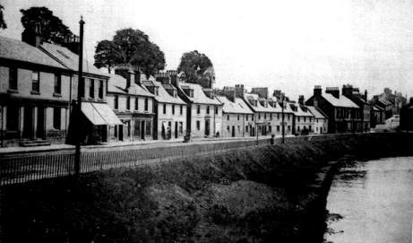
Not to be excluded, the Dumbarton magistrates petitioned the Privy Council for a bridge in 1680, saying in support of their claim that the road between Stirling and Dumbarton, which passed through Bonhill, had “neither meat nor safety”. What became Main Street Bonhill was therefore a significant droving route from the 1500's right up until droving died out about 1900, although different parts of it were used at different times.
In the early days, the Dumbarton - Stirling road was little more than a drover's track. Between Dumbarton and Bonhill it followed a line close to the river, across what became Strathleven Estate before crossing the Red Burn and then turning east to come up what became Cordale Loan. It then turned sharply north and shortly after that split with one branch continuing down through the centre of the village, while the other track stayed higher, becoming known as “The High Road” passing to the east side of the village to join up with Hillbank in the area of the quarry.
It was only when Strathleven Estate (then known as Levenside Estate) was laid out, and Strathleven House built in the early 1700's that the line of the road was changed to run on the east side of the Estate - for the convenience of the landowner, of course. John Agnew in his book, “The Story of the Vale of Leven”, says that the old route through the Strathleven Estate remained a right of way until the early 1900's. When the Industrial Estate was built after 1945 that, of course, became academic, with access open to all.
PAGE 2 | PAGE 3 | PAGE 4 | PAGE 5
![]()