History of the Vale of Leven Page 2
Page 1 | Page 3 | Page 4 | Page 5
There are 5 towns and villages in the Vale - Renton, Alexandria on the west side of the River Leven, Bonhill and Jamestown on the east side, and Balloch which straddles the Leven close to where it leaves Loch Lomond on its short and fast journey to Loch Lomond. The village of Gartocharn lies on the east side of the Loch about 3 miles north east of Balloch, while Luss lies on the west shore of the Loch about 8 miles from Balloch.
The first administrative organisation in Scotland was actually set up by the Church in the middle ages to try to help it be more effective. In the middle ages, the country was divided into geographic parishes, which were supposed to represent an area, which could be supported by 1 minister. Since the population in most places was quite sparse and the area to be covered quite large relative to the means of communications within it, most parishes were large for one man, while many to-day seem a bit irrational e.g. why would Renton be placed in Cardross parish rather than Bonhill? The answer is probably that whatever maps existed when the boundaries were being drawn up were flat without contours or any description of the topography, and the boundary makers were mostly remote from the areas they were parcelling up.
However, the parishes were important because the government adopted them as convenient units of civil government and for hundreds of years the basis on which whatever central governing was actually being done was delivered to the people, or collected from them. The most obvious examples of this are births, marriages and deaths, and population surveys, but it extends to education, taxation, poor law relief an early version of social security), and road building and maintenance.
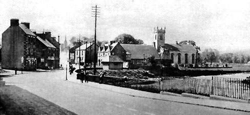
An old image of Bonhill
There are 2 historic parishes in the Vale - Bonhill into which fall Bonhill, Alexandria, Jamestown and Balloch, and Cardross, which includes Renton. The parish names can cause a lot of confusion, especially historically, but hopefully that issue will be addressed as it arises. Luss is in the historic parish of Luss, while Gartocharn is in the historic parish of Kilmaronock. The parishes have retained their boundaries since the mid 17th century. In 1648 Bonhill was enlarged by the transfer into it of Tilliechewan, Stockragent, Cameron and Auchindennan from Luss parish, and further enlarged in 1650 by the transfer from Kilmaronock of Balloch, Milton (adjacent to Ballaghan), Blairhosh and Ledrishbeg.
Like place-names everywhere there are various explanations of the origin of the name “Leven”, but the most commonly accepted, because it has most supporting evidence, is that it is derived from the Gaelic “Leamhan” which means elm water. The elm was one of the emblems of the Earls of Lennox who were the dominant family in much of what is now Dunbartonshire and west Stirlingshire from early medieval times until the late 1500's.
Then their involvement with the plots and counter plots around Mary Queen of Scots led to the eventual disappearance of the Earldom and the loss of the lands from a locally based Lennox Stewart family. On the other hand, the Earl's son, Lord Darnley, married his cousin, Mary Queen of Scots (a disastrous marriage it is true) and produced a son who became James VI of Scotland and I of England - and the Earl of Lennox. Thus from that time on every monarch of the United Kingdom has had Lennox Stewart blood in their veins - although to be fair, you don't usually think of the Queen as a Vale wummin.
Long before that, the Earls of Lennox and the “Men of Lennox” had earned themselves a proud place in Scotland's history. The Earls had led their men to innumerable battlefields among them Bannockburn, where their valour drew admiration from Robert the 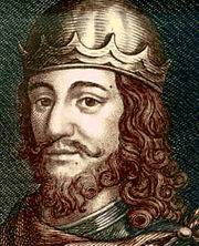 Bruce himself. The high regard in which the Earldom was held derived partly from the Earls themselves, partly from their people and partly from the strategic importance of the area the Lennox's occupied.
The people of this area have thus played a long and colourful role in Scottish history. Although for many centuries small in numbers, the people of the area have made an impact on history, by making good use of whatever advantages each age proved the geography to have.
From the outset of the history from which we can derive even the most marginal meaning, the visual evidence says it all - the hills. Hills in the Highlands and dense forests elsewhere made communications land-based difficult in virtually every direction and the sea, rivers and lochs were the preferred lines of communication from the beginning of identifiable history in Scotland. All stone age and then Bronze age developments, which have been found in Scotland, are close to the sea or rivers. The Vale of Leven is well placed for both and it is perhaps surprising that more evidence for 3-5000 year old inhabitation has not been found in the area. That doesn't mean to say that it isn't there - just that past and current archaeological techniques have not uncovered them.
There is an additional irony in that the one major stone age fort - on Carman Hill (or Mount Mallow or the standing stones as the site is colloquially known) which commands wonderful views across the Vale and up and down the Clyde - which was “found” by an aerial archaeological survey in 1954, is now thought not to be stone age at all. Current thinking is that it is probably a vitrified fort built much later and certainly occupied after Roman times. The site awaits excavation, but is thought to have been at least 6 acres in area - roughly equivalent to the area occupied by Dalmonach Works - so in time it may well shed considerable light on the Dark Ages. The only provable Stone Age site in the Vale is close to Pappert Hill above Bonhill, which has standing stones on Standing Stone Hill.
(More info on the Carman Hill Fort here.)
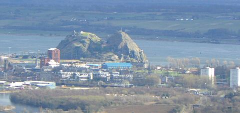
Looking back on Dumbarton and the Rock from Mount Mallow
By Roman times - that is about 2,000 years ago - we know that strong-willed people who were more than capable of defending themselves inhabited the area. We also know that there were enough of them to keep the Romans at bay and that the Antonine wall built in the 1st century AD was the north-western frontier of the Roman Empire, and probably not for any more than 40 years at that. The historian Ian Grimble summed it all up perfectly in a television series 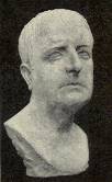 he did on the history of Scotland in the late 1960's. Standing on Dumbarton Rock and with the camera shot looking straight up the Vale panning onto Renton first, he said, “This is as far as the Romans got in north-west Europe. To paraphrase Julius Caesar, they came, they saw, they left in a hurry”. To day looking down from the Rock it would probably be the sight of Dumbarton's football team which would drive them away. At that time it was the resistance of the locals which proved too much for the Romans.
The Romans didn't leave the whole of Scotland at that time, and there were other incursions by Romans legions but north of the Antonine wall the local people began to emerge into the group we now call the Picts, and they were one of the main factors in the gradual collapse of Roman control in northern Britain over the course of the 4th and 5th centuries. Unfortunately, there is virtually no physical evidence - written, ruins, artifacts or aerial photography - of whom these people were or what they were like. Scotland was not a kingdom of course at this time, more a network of interlocking kingdoms which came and went and which were sometimes in conflict sometimes in alliance.
New groupings such as the Britons emerged from contact
and conquest, and by the 6th century it is possible to identify a kingdom of
Britons based around Dumbarton Rock. It is called Al Clud by some historians
and Al Clut by others and survives in the name of Alclutha. By 731 the chronicler
Bede writing in Northumbria, wrote of Altclut “the rock on the Clyde” and it was still the capital of a kingdom, which covered the area of what is now Dunbartonshire and Renfrewshire and therefore included the Vale. It survived better than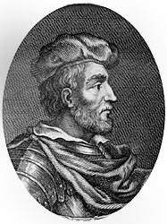 most
other similar kingdoms later becoming the core of the kingdom popularly known
as Strathclyde, which for a time stretched from Glen Falloch in the north to
Morecambe Bay in north Lancashire in the south.
most
other similar kingdoms later becoming the core of the kingdom popularly known
as Strathclyde, which for a time stretched from Glen Falloch in the north to
Morecambe Bay in north Lancashire in the south.
Strathclyde also proved to be a survivor. It was only when Owen the Bald, King of Strathclyde, died in 1018 that the King of the Picts and Scots, Malcolm II was able to make his grandson Duncan (pictured), King at Dumbarton. On Malcolm's death in 1034 he was succeeded by Duncan who was the first king for all of Scotland - except for the parts under the control of the Norsemen. The locals had had a few close shaves along the way of course. Perhaps the best known was in 870 when Norsemen and Danes from Dublin captured Dumbarton after a 4-month siege.
They came back again 400 years later in 1263 when King Hakon of Norway was trying to win back the Western Isles. In that raid they sailed up Loch Long, rolled their 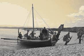 longships across to Loch Lomond from Arrochar, raided Loch Lomondside and the Vale and returned to the Clyde via the Leven.
The other people who touched on the Vale were the Gaels who inhabited Argyll and the Western Isles and had very close family and economic connections with Ireland, having originally come from there. Their kingdom was called Dal Riata and they edged eastward as settlers and missionaries carrying Christianity from the 6th century onwards to both the Picts and the Britons. That the Gaels had influence and probably ownership in this area is known, not from any evidence of the 5th - 8th centuries, that does not exist, but from later documented law and custom in the Lennox lands which were found to be based on Gaelic laws.
It is also known from the proliferation of Gaelic names in the area, a list of the better known appears below. Some of these place names were probably introduce by the Celtic missionaries who are known to have carried Christianity to the area. Foremost amongst them was Saint Kessog of Luss, who had a monastery on Inchtavannach (the “island of the monastery”) and who is believed to have been murdered at Bandry just south of Luss in either 520 or 560 - the uncertainty of whether this actually happened and when is just further illustration of how little is known for certain before documentary proof begins to emerge at the beginning of the 13th century. In any event, a cairn depicting Saint Kessog was erected on the site where his murder was believed to have taken place. It was only removed in the 18th century by the soldiers building the road up the side of the Loch, and can now be found in Luss church.
What else is believed between this time and the early middle ages is that the Earldom of Lennox was created sometime after 1072, by Malcolm III, for a Northumbrian chief who stood by Malcolm when under attack from William the Conqueror, in recompense for the land which William took from the chief in Northumbria. At that time boundaries were not defined or observed very strictly, so we don't know exactly what land it involved but we may be sure that the Earl didn't stint himself.
A charter was granted in 1238 by Alexander II to the then Earl of Lennox and did define the lands more clearly as being much of Dunbartonshire (excluding Dumbarton Castle) and western Stirlingshire, and this remained the Earldom for the next 200 or so years, with most subsequent landowners gaining outright ownership of their land after the partition of the Lennox in 1425 or the extinction of the old local Earldom in 1672. The major exception to this in the area of the Vale was the Colquhoun family, of whom more below.
From this time onwards some of the local place names appear in written format for the first time - a church at Bonhill is mentioned in a charter of about 1250, while in 1273 Earl Malcolm gives the Abbey and Convent of Paisley certain fishing rights on the Leven, and also wood from his grove of Bonhill, while the monks from Paisley were granted further rights to fish at Linnbrane in 1330. In 1370 we hear of Buchanan and Sallachy for the first time in a charter which states that executions had to take place on the Earl of Lennox's own gallows at Catter where the Balloch Drymen road meets the Glasgow Drymen road just before Drymen Bridge. The Earl of Lennox by this time had one of his castle's there. The lands of Tillichewan are mentioned in 1384.
Other things which we can be reasonably confident about in this part of the early Middle Ages, without knowing much of the detail, is that both William Wallace (pictured) and Robert the 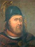 Bruce were active in the area at times. Blind Harry's “Wallace”, written in the late 1400's - and a favourite book of Burns, being the first or second book he ever read - refers to Wallace escaping from English soldiers by making use of a subterranean passage from the shore at Havock to Carman Hill, a distance of about a mile. If such a passage ever existed, which frankly seems a bit unlikely, it has been lost to time. However, it does seem perfectly possible that Wallace did escape onto Carman Hill by some other cover such as thick undergrowth.
Bruce was familiar with the area. Long before he spent his last years in the Castlehill area of Dumbarton where he died in 1329, he had used the Loch as an escape route and a refuge after losing to the English at the battle of Metheven 1306. He was a friend of Malcolm the 5th Earl of Lennox, who was one of only two earls to fight at Bruce's side at Metheven, and sheltered on the shores of the Loch before eventually heading for Kintyre, Ulster and back and of course his rendezvous with the spider. The dent in the rocks (pictured) just north of Inversnaid which is promoted to tourists as “Rob Roy's Cave”, also hosted Robert the 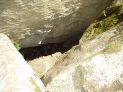 Bruce if you are to believe recently generated “ancient tradition”. In his later years after Bannockburn he came to live at Castlehill and it is widely believed that he may have had a hunting lodge in the area of what was Mains of Cardross farmhouse, which lies about half a mile north of Dumbarton, between the railway line and the River Leven.
Malcolm the 5th Earl of Lennox is a figure of note in the fight for Scottish independence. He inherited the title in either 1290 or 1292 and for virtually the whole of his lifetime Scotland was either engaged in war against England for its independence or engaged in internal battles for control of the crown. Malcolm was a friend and mentor of Bruce who stood by him through thick and thin. He was also a signatory of the Declaration of Arbroath in 1320, his seal being one of the few remaining.
As an old man he returned to the fray to fight the English at what turned out to be a disaster for the Scottish nobility where it was virtually annihilated - the battle of Halidon Hill in 1333 which reversed for a time all of the late Robert the Bruce's victories. Earl Malcolm was killed in the battle, as were many of the men of the Lennox who had followed their leader in his fights on Bruce's behalf over the years.
Page 1 | Page 3 | Page 4 | Page 5
![]()